GeoPortOst
ArcGIS, QGIS or web apps can simply use this map with web map services. WMTS, TileJSON or XYZ tiles are provided for quick access to processed maps.
Sign in to get links.
Sign in to download GeoTIFF.
Overlay & compare
Website
Original viewer
Catalog
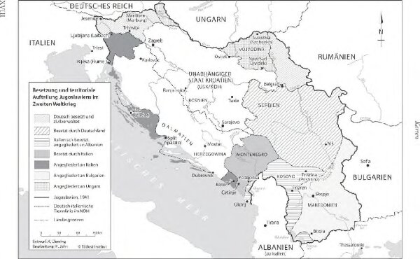
Besetzung und territoriale Aufteilung Jugoslawiens im Zweiten Weltkrieg
BV044906986
GeoPortOst II
Jugoslawien Besetzung, Weltkrieg <1939-1945>
From 1941 to 1945
2011
Clewing, Konrad ; John, Holger W.
1 : 2500000