GeoPortOst
ArcGIS, QGIS or web apps can simply use this map with web map services. WMTS, TileJSON or XYZ tiles are provided for quick access to processed maps.
Sign in to get links.
Sign in to download GeoTIFF.
Overlay & compare
Website
Original viewer
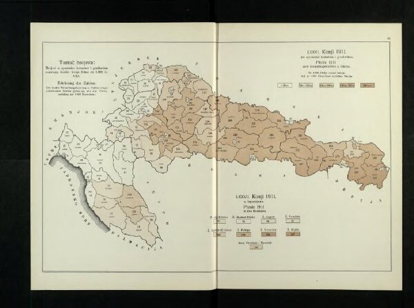
Konji 1911. po upravnim kotarima i gradovima
BV042745331
pilot
Kroatien Slawonien Verbreitungskarte Statistik Pferd
1911
1915
26 × 40 cm