GeoPortOst
ArcGIS, QGIS or web apps can simply use this map with web map services. WMTS, TileJSON or XYZ tiles are provided for quick access to processed maps.
Sign in to get links.
Sign in to download GeoTIFF.
Overlay & compare
Website
Original viewer
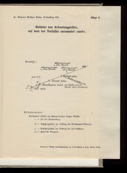
Gelände des Erkundungsrittes, auf dem der Verfasser verwundet wurde
BV042758162
pilot
Türkei Osmanisches Reich Balkankrieg <1912-1913> Mahmud, Muhtar Paşa
1913
22 × 18 cm