GeoPortOst
ArcGIS, QGIS or web apps can simply use this map with web map services. WMTS, TileJSON or XYZ tiles are provided for quick access to processed maps.
Sign in to get links.
Sign in to download GeoTIFF.
Overlay & compare
Website
Original viewer
Catalog
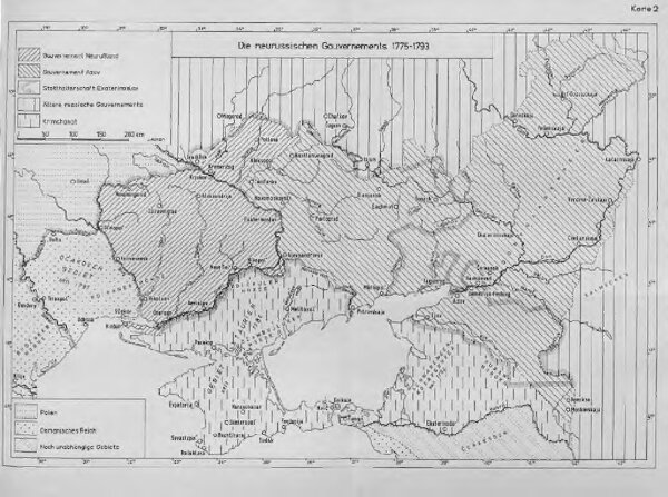
Die neurussischen Gouvernements 1775-1793
BV044795445
GeoPortOst II
Ukraine (Süd), Neurussland, Verwaltungsgliederung
From 1775 to 1793
1965
Anton, J.