GeoPortOst
ArcGIS, QGIS or web apps can simply use this map with web map services. WMTS, TileJSON or XYZ tiles are provided for quick access to processed maps.
Sign in to get links.
Sign in to download GeoTIFF.
Overlay & compare
Website
Original viewer
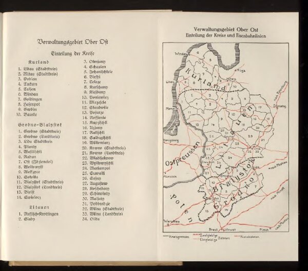
Verwaltungsgebiet Ober Ost. Einteilung der Kreise und Eisenbahnlinien
BV042517811
pilot
Baltikum Oberost Weltkrieg <1914-1918> Eisenbahnnetz
1917
15.5 × 10 cm