GeoPortOst
ArcGIS, QGIS or web apps can simply use this map with web map services. WMTS, TileJSON or XYZ tiles are provided for quick access to processed maps.
Sign in to get links.
Sign in to download GeoTIFF.
Overlay & compare
Website
Original viewer
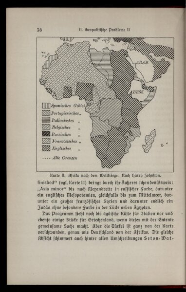
Karte II: Afrika nach dem Weltkriege
BV043434169
pilot
Afrika
1918
1916
Johnston, Harry
10 × 11 cm