GeoPortOst
ArcGIS, QGIS or web apps can simply use this map with web map services. WMTS, TileJSON or XYZ tiles are provided for quick access to processed maps.
Sign in to get links.
Sign in to download GeoTIFF.
Overlay & compare
Website
Original viewer
Catalog
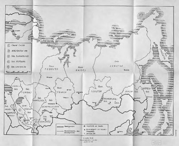
Russisches Reich. Verwaltungsgrenzen von 1914. Asiatischer Teil
BV044856293
GeoPortOst II
Russland / Asiatischer Tei Verwaltungsgliederung
1914
1966