GeoPortOst
ArcGIS, QGIS or web apps can simply use this map with web map services. WMTS, TileJSON or XYZ tiles are provided for quick access to processed maps.
Sign in to get links.
Sign in to download GeoTIFF.
Overlay & compare
Website
Original viewer
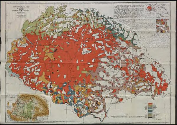
Ethnographical map of Hungary based on the density of population
BV036862917
pilot
Ungarn Ethnische Gruppe Teleki, Pál
1922
Teleki, Pál
1 : 1000000