GeoPortOst
ArcGIS, QGIS or web apps can simply use this map with web map services. WMTS, TileJSON or XYZ tiles are provided for quick access to processed maps.
Sign in to get links.
Sign in to download GeoTIFF.
Overlay & compare
Website
Original viewer
Catalog
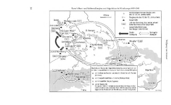
Bunt- und Edelmetallbergbau und Saigerhütten in Mitteleuropa 1419-1540
BV044876034
GeoPortOst II
Mitteleuropa Bergbau, Hüttenindustrie
From 1419 to 1540
1995