GeoPortOst
ArcGIS, QGIS or web apps can simply use this map with web map services. WMTS, TileJSON or XYZ tiles are provided for quick access to processed maps.
Sign in to get links.
Sign in to download GeoTIFF.
Overlay & compare
Website
Original viewer
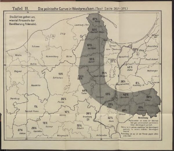
Die polnische Curve in Westpreußen
BV042512252
pilot
Polen Westpreußen Polen Bevölkerung
From 1871 to 1910
1910
24 × 29 cm