GeoPortOst
ArcGIS, QGIS or web apps can simply use this map with web map services. WMTS, TileJSON or XYZ tiles are provided for quick access to processed maps.
Sign in to get links.
Sign in to download GeoTIFF.
Overlay & compare
Website
Original viewer
Catalog
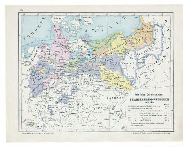
Die hist. Entwicklung von Brandenburg-Preussen seit 1415
gbvppn_683323598_24
GeoPortOst II
Mitteleuropa, Preußen, Expansion
From 1415 to 1904
1904