GeoPortOst
ArcGIS, QGIS or web apps can simply use this map with web map services. WMTS, TileJSON or XYZ tiles are provided for quick access to processed maps.
Sign in to get links.
Sign in to download GeoTIFF.
Overlay & compare
Website
Original viewer
Catalog
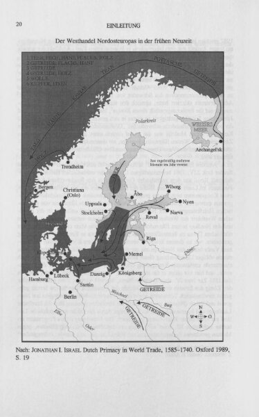
Der Westhandel Nordosteuropas in der Frühen Neuzeit
BV044790510
GeoPortOst II
Europa (Nordost) Handel
From 1350 to 1499
1997