GeoPortOst
ArcGIS, QGIS or web apps can simply use this map with web map services. WMTS, TileJSON or XYZ tiles are provided for quick access to processed maps.
Sign in to get links.
Sign in to download GeoTIFF.
Overlay & compare
Website
Original viewer
Catalog
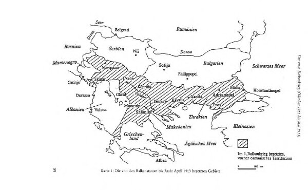
Die von den Balkanstaaten bis Ende April 1913 besetzten Gebiete
BV044766674
GeoPortOst II
Südosteuropa, Osmanisches Reich, Balkankriege
1913
1996
Häusler, Ines