GeoPortOst
ArcGIS, QGIS or web apps can simply use this map with web map services. WMTS, TileJSON or XYZ tiles are provided for quick access to processed maps.
Sign in to get links.
Sign in to download GeoTIFF.
Overlay & compare
Website
Original viewer
Catalog
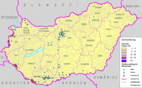
Kroaten in Ungarn (2001) und ihre Selbstverwaltung (2004)
BV044943371_1
GeoPortOst II
Ungarn Kroaten, Selbstverwaltung
From 2001 to 2004
2018
Bottlik, Zsolt