GeoPortOst
ArcGIS, QGIS or web apps can simply use this map with web map services. WMTS, TileJSON or XYZ tiles are provided for quick access to processed maps.
Sign in to get links.
Sign in to download GeoTIFF.
Overlay & compare
Website
Original viewer
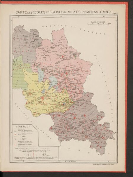
Carte des écoles et églises du vilayet de Monastir (1908)
BV042751147
pilot
Makedonien Vilâyet Manastır Osmanisches Reich Kirchenbau Schulgebäude
1908
1919
Kümmerly & Frey
24 × 17 cm