GeoPortOst
ArcGIS, QGIS or web apps can simply use this map with web map services. WMTS, TileJSON or XYZ tiles are provided for quick access to processed maps.
Sign in to get links.
Sign in to download GeoTIFF.
Overlay & compare
Website
Original viewer
Catalog
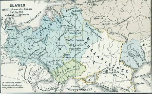
Slawen nördlich der Donau 850 bis 900
gbvppn_685000710_117_8
GeoPortOst II
Ostmitteleuropa Slawen
From 850 to 900
1880
1 : 24000000