GeoPortOst
ArcGIS, QGIS or web apps can simply use this map with web map services. WMTS, TileJSON or XYZ tiles are provided for quick access to processed maps.
Sign in to get links.
Sign in to download GeoTIFF.
Overlay & compare
Website
Original viewer
Catalog
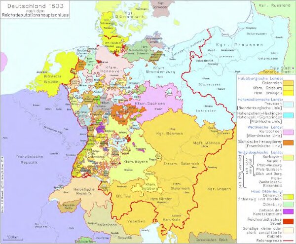
Deutschland 1803 nach dem Reichsdeputationshauptschluss
hebisppn_400724065
GeoPortOst II
Deutschland Reichsdeputationshauptschluss
1803
2014
Kunz, Andreas ; Moeschl, Joachim Robert