GeoPortOst
ArcGIS, QGIS or web apps can simply use this map with web map services. WMTS, TileJSON or XYZ tiles are provided for quick access to processed maps.
Sign in to get links.
Sign in to download GeoTIFF.
Overlay & compare
Website
Original viewer
Catalog
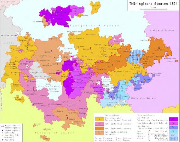
Thüringische Staaten 1834
hebisppn_402369963
GeoPortOst II
Thüringen
1834
2009
Kunz, Andreas ; Moeschl, Joachim Robert