GeoPortOst
ArcGIS, QGIS or web apps can simply use this map with web map services. WMTS, TileJSON or XYZ tiles are provided for quick access to processed maps.
Sign in to get links.
Sign in to download GeoTIFF.
Overlay & compare
Website
Original viewer
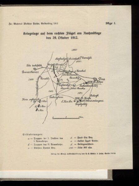
Kriegslage auf dem rechten Flügel am Nachmittage des 29. Oktober 1912
BV042757919
pilot
Türkei Osmanisches Reich Kırklareli Balkankrieg <1912-1913> Mahmud, Muhtar Paşa
1912
1913
22 × 19 cm