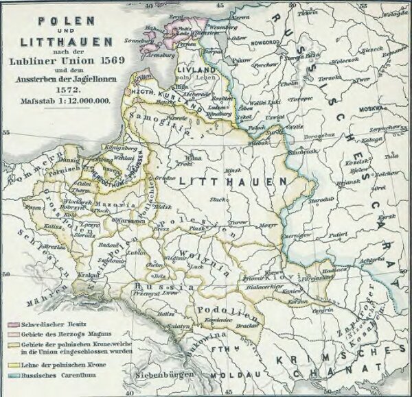
Polen und Litthauen nach der Lubliner Union 1569 und dem Aussterben der Jagiellonen 1572
ArcGIS, QGIS or web apps can simply
use this map with web map services.
WMTS, TileJSON or XYZ tiles
are provided for quick access to processed maps.
Sign in to get links.