GeoPortOst
ArcGIS, QGIS or web apps can simply use this map with web map services. WMTS, TileJSON or XYZ tiles are provided for quick access to processed maps.
Sign in to get links.
Sign in to download GeoTIFF.
Overlay & compare
Website
Original viewer
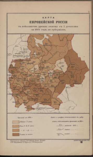
Karta Evropejskoj Rossīi s pokazanīem urožaja jačmenja s 1 desjatiny
BV042535050
pilot
Russland Russland Landwirtschaft Statistik
1884
1885
Zverinskij, V.V.; Petrovskij, A.N.