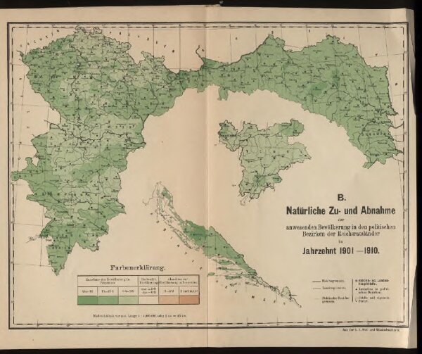
Natürliche Zu- und Abnahme der anwesenden Bevölkerung in den politischen Bezirken der Reichsratsländer im Jahrzehnt 1901 – 1910
ArcGIS, QGIS or web apps can simply
use this map with web map services.
WMTS, TileJSON or XYZ tiles
are provided for quick access to processed maps.
Sign in to get links.