GeoPortOst
ArcGIS, QGIS or web apps can simply use this map with web map services. WMTS, TileJSON or XYZ tiles are provided for quick access to processed maps.
Sign in to get links.
Sign in to download GeoTIFF.
Overlay & compare
Website
Original viewer
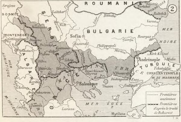
Modifications territoriales dans le Balkans: Traité de Bukarest
BV043717455
pilot
Balkanhalbinsel Bukarest / Friede <1913>
1913
1914