GeoPortOst
ArcGIS, QGIS or web apps can simply use this map with web map services. WMTS, TileJSON or XYZ tiles are provided for quick access to processed maps.
Sign in to get links.
Sign in to download GeoTIFF.
Overlay & compare
Website
Original viewer
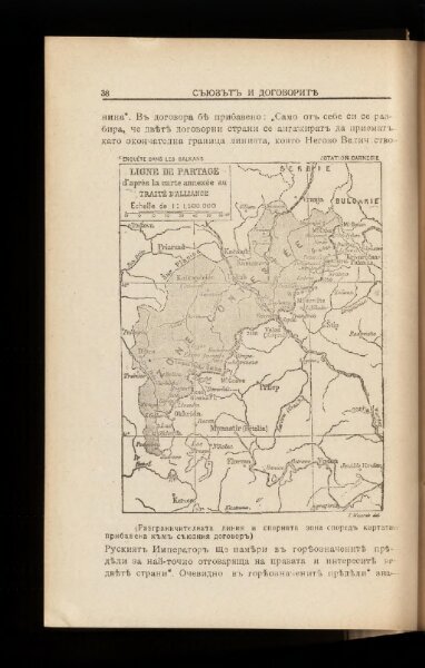
Ligne de partage d'après la carte annexée au traité d'alliance
BV043564318
pilot
Balkanhalbinsel Grenze Balkankrieg <1912-1913> Annexion
From 1912 to 1913
1917
13 × 10 cm