GeoPortOst
ArcGIS, QGIS or web apps can simply use this map with web map services. WMTS, TileJSON or XYZ tiles are provided for quick access to processed maps.
Sign in to get links.
Sign in to download GeoTIFF.
Overlay & compare
Website
Original viewer
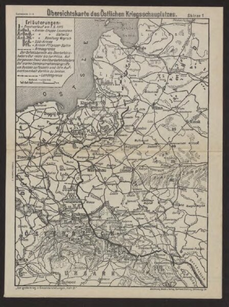
Übersichtskarte des Östlichen Kriegsschauplatzes
BV043433854
pilot
Osteuropa Polen Litauen Weißrussland Galizien und Lodomerien Weltkrieg <1914-1918>
1915
1918
Verl. Gerhard Stalling, Oldenburg
21.5 × 28.5 cm
1 : 4500000